Wednesday, November 29, 2006

The Bolinao Experience

Bolinao emerges arguably as the most desirable tourist destination in our province. The complete beauty and gift of nature is displayed here. Waterfalls, caves, white sand beaches, hills, and ancient artifacts are the awesome reasons why a nature lover has to come.

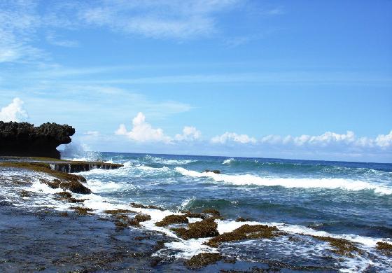
For my feet to step in this magnificent place was a great experience. We went to the remotest western part as the pristine Patar beach caught my attention. I beheld and touched the purest water that I could ever imagine that time compare to the beaches I'd been. The coldness of the seawater in the morning and the direct heat from the sun adds up to the excitement of swimming and playing.

Of course the travel wouldn't be complete without going to one of the caves. After that we dropped to the waterfalls, it was a dreamed come true. It sounds weird but I never known any falls other than the popular Pagsanjan. This time I decided not to get wet.

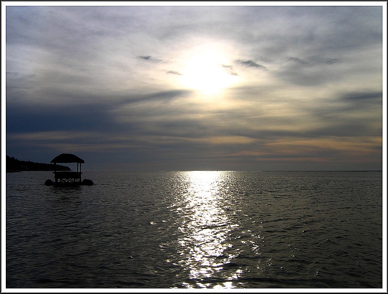
Words are not enough to describe Bolinao. You can make your own story once you have been there. I was there!

WHERE TO STAY:

Puerto del Sol - nice resort with almost 5 star (Bolinao standard) amenities. of course, very expensive. http://www.puertodelsol.com.ph

Treasures of Bolinao - expensive as well. They have a room with a full-floor glass window perfect for watching the sunset.

Tuesday, November 28, 2006

The Longest Bridge in Luzon


During the administration of Fidel V. Ramos which is from Pangasinan the roads around the province had improved dramatically. The widening and cementing significantly made the people satisfied. Furthermore, the vehicles move smoothly like never before.

One of the most important projects of Ramos as the president of the Philippines was the building of the 1.4 km. bridge connecting the towns of Asingan and Sta. Maria. It is considered to be the second longest bridge in the Philippines behind the San Juanico bridge.

It connects the towns of the District 5 to the District 6. Before a passenger from San Nicolas had to pass Tayug Sta Maria, Rosales, the Carmen bridge, and Villasis to go to Urdaneta. An estimated of 35-45 minutes of time travel has been eliminated by the bridge.

People from San Manuel would no longer dare to walk through the stones and waters of Agno river and passing Barangay San Rafael to San Nicolas. They will now utilize this road without stepping on the speedy water of the Agno river.

Urdaneta city keeps growing


I am recently amazed by the improvements of the City of Urdaneta. Financially, the Commission on Audit for 2005 released that Urdaneta City is the leading city not only in Pangasinan but the entire Region I in terms of income.(see). It overtakes Dagupan City which considered to be a highly urbanized city( Cities with a minimum population of two hundred thousand (200,000) inhabitants, as certified by the National Statistics Office, and with the latest annual income of at least Fifty Million Pesos (P50,000,000.00) based on 1991 constant prices, as certified by the city treasurer) while Urdaneta is only a component city of Pangasinan.

The days are gone when the people of Eastern Pangasinan used to travel hours to go to Dagupan to transact business and experience the city life. Department and variety stores, business and professional offices, hotels and theaters can now be found here. Jollibee, McDonald's, Shakeys, Cindys, Chowking and KFC are minutes away from San Nicolas, Tayug, Natividad, Sta Maria, Asingan, Binalonan, Villasis, San Manuel, Rosales, and other nearby towns.

In the past years, one of the biggest problems is the traffic in MacArthur Highway. Those days of slow movement of transportation will be over soon. There is no flyover built but the road widening is now complete. There will be a smooth flow of vehicles. And the irritations of thousands will be gone. It will save time to reach the city.

I believe that Urdaneta city, not long from now, will be considered a highly urbanized city. The economy will boom as business opportunies will grow.

Friday, November 24, 2006

Pangasinan


Pangasinan is one of the 77 provinces of the Republic of the Philippines.
Etymology.The term pangasinan means "land of salt" or "place where salt is made" from the root word asin meaning salt in the native language, and the prefix pang and the suffix an meaning place. The term was derived from one of the main occupations of the people in the coastal villages which was, and still is, that of making salt from sea water through the process of solar evaporation in well-laid-out salt beds.
Though not popularly known today, the other name of the region was Caboloan. The root term of the word Caboloan is boló, which in the Pangasinan language refers to a species of bamboo. Caboloan would mean a place where the boló is generally found. The boló is a special kind of bamboo, unlike the kawayan, it does not grow everywhere in the region. It is highly useful in making baskets, sawali and bilao because of its thinness and lightness which make it especially adaptable to weaving. In the early sixteenth century this species of bamboo abounded in the inland plains but due to indiscriminate cutting, it is now rarely found if not in near extinction.
Before the Spanish conquest, the name Pangasinan applied only to the coastal areas, where salt was made, and Caboloan was more common name applied to the interior plains where the boló was abundant. At the time of the Spanish conquest, it was the coastal salt-making region that was occupied first by the Spaniards and the later applied the name Pangasinan to the whole place populated by the same language group. Thus, the name Caboloan fell into disuse, more so after the boló itelf almost extinct in the region where it once flourished.
The province was referred to as Feng-Shia-Shih tan in a Chinese manuscript of the sixteenth century.
Pangasinan is a long, wide, verdant crescent bounded by the wild Zambales range to the west and to the east by the Cordilleras -- the formidable mountains that form the spine of the island of Luzon. To the south, Pangasinan extends to the rice-and-sugar farmlands of Tarlac, and north to the crowning glory of Lingayen Gulf and the South China Sea. This shoreline is a great arc of variegated character: from fantastically tall, craggy rock roughly chiseled by the surf, to the mildest of white sand beaches. The coast is fringed by well-hidden coves and inlets, promontories and caves, forests and woodland, charming fishing villages, and then the islands. It faces the Asian mainland, outstretched widely in anticipation and welcome.
The province experiences a pronounced dry season from November to April and a wet season from May to October.